Day 11: Bowling Green, KY to Jefferson City, MO
Time & Distance: 10 hrs, 52 mins, 761 kms
States Crossed: Kentucky, Illinois
We had a later start today and it really payed off. Everyone felt more rested and we covered more distance than previous days. It was mostly super-slabs from Bowling Green to Park Hills, just south of St. Louis. Stan was fortunate enough to find a dealer in town that was willing take a left-hand mirror off a floor model VFR. Thank God cause being half-blind on the Interstate isn't necessarily the safest thing. We decided to detour through Jefferson City to avoid the St. Louis rush hour traffic. We were recommended to take Route #8 by some guys at the dealer and it turned out to be a nice little surprise. It was a quiet single-lane highway with fresh asphalt and rolling hills. In fact the first serious of the hills had so many up & downs that it felt like a roller coaster. I was giggling like a child inside my helmet as I gassed up to get that airborne feeling. This highway went through rural small towns and was a very welcome change from the baren Interstates that we have been doing.
I must've gotten carried away, cause I got stopped by a cop and never saw him coming. I was going 45 miles/hr in a 35 miles/hr city zone. I played the sympathy & ignorant card stating nightfall dangers and mile to kilometer conversions. I explained that I wanted to get to Jefferson City before dark and I didn't want to be on the highway because of wildlife. I also pointed to my speedo and told him that I still could not figure out kms & miles. Ultimately, a nice smile and politeness got me off with only a verbal warning.
We checked into Jefferson city and ended the night with some beer and snacks by the hot tub.

Day 12: Jefferson City, MO to North Platte, NE
Time & Distance: 11 hrs, 1 mins, 941 kms
States Crossed: Missouri
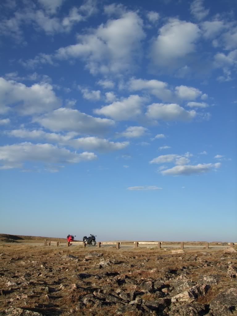
Today was a straight run from Jefferson City to North Platte. There was nothing interesting, just same severe prairie crosswind that greeted us like a persistent foe. It slapped us around on the interstate like a kite. This time though, we were prepared and are well trained from the last mid-west crossing. The only thing we saw of interests on the interstate was the Girls Gone Wild Bus. It was going the opposite direction from us, but we did briefly consider following it to the next college town.
At one of the rest stops, we learned that the Interstate highway system was developed by Eisenhower. He was a military president who felt the need for a roadway system to quickly move people and more importantly, army vehicles across the great country.
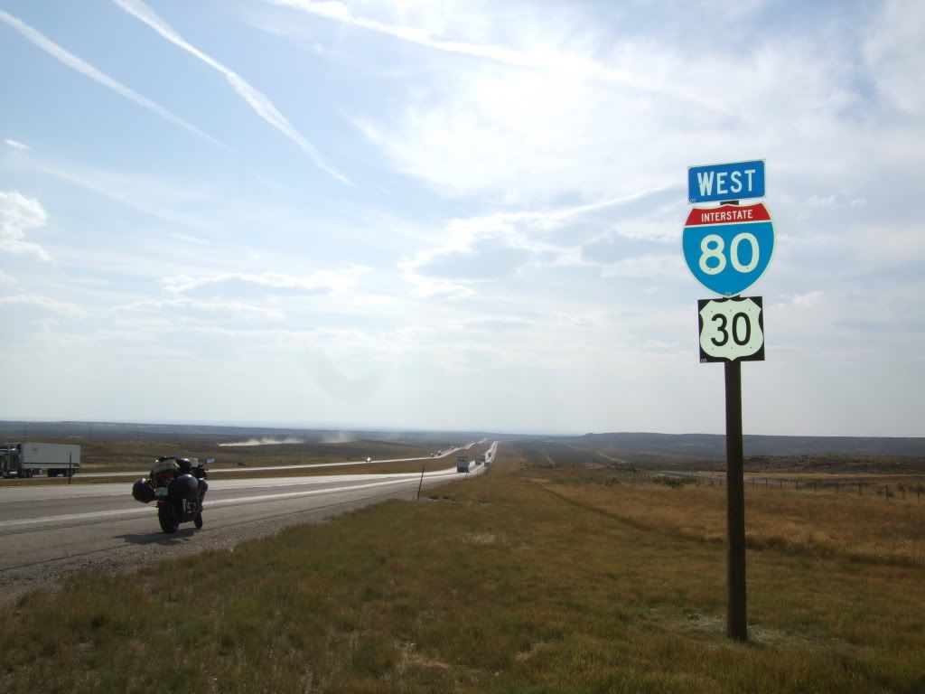
Day 13: North Platte, NE to Evanston, WY
Time & Distance: 12 hrs, 48 mins, 956 kms
States Crossed: Nebraska, Wyoming
We were so eager (not to mentioned exhausted) to go home that we just took the fastest and most direct route for the final few days. Nothing much happened that's worth mentioning so below will just be the time and mileage logs for each day.
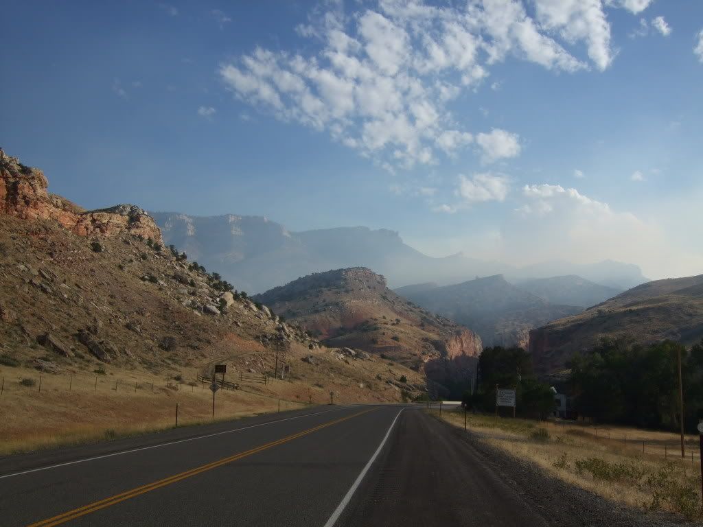
Day 14: Evanston, WY to Baker City, OR
Time & Distance: 12 hrs, 3 mins, 859 kms
States Crossed: Idaho
Day 15: Baker City, OR to Vancouver, BC
Time & Distance: 11 hrs, 17 mins, 838 kms
States Crossed: Washington
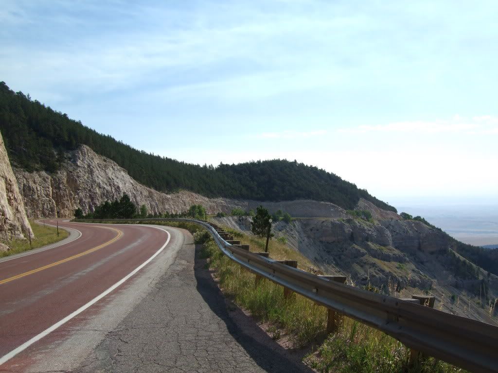
We've been lucky through out the whole trip to avoid the friendly highway patrol; that is until today. We were making our way through the Washington mountains a couple of hour east of Greater Seattle when we were tracked by air patrol. The whole bunch of us along with several other cars were pulled over by four troopers waiting a few minutes ahead. I was pulled over by a motorcyle cop so I tried the sympathy card on him. Although he was sympathetic to us and our long journey, we were not able to avoid the ticket.
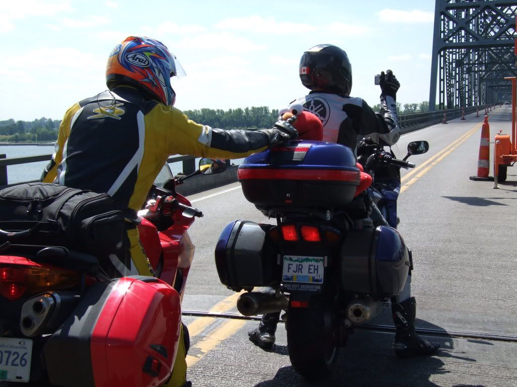
We continued on and as we saw Seattle come into view, it felt like we were home already. Another hour later, the border lineup was an odd welcome sight. It's kinda like when you stare down at your own city from the plane on a return trip. It just feels nice to know that you'll be back on canadian soil.
The minute I put the bike away, the minute I walked in the door and took of my gear; I must have just crashed and hibernated for at least 12 hours. But wow, what a trip!
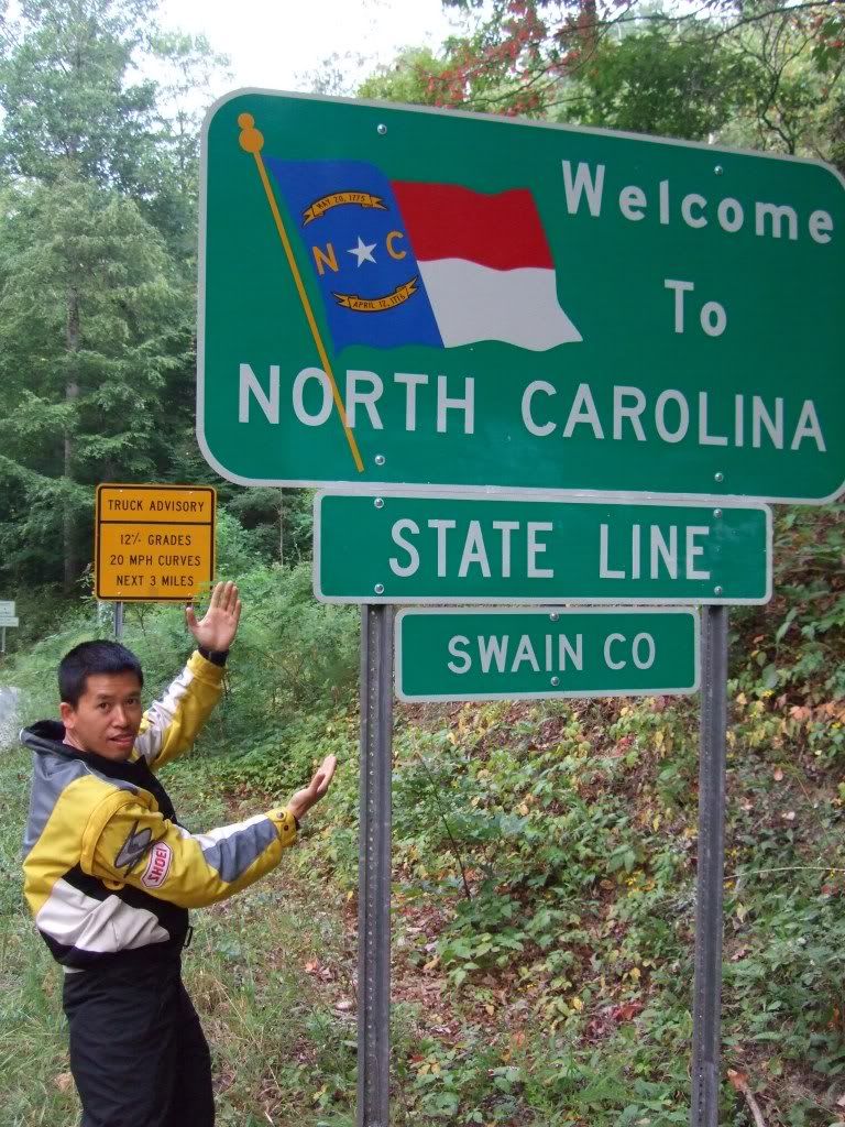
 We continued on our way in the morning and it wasn't before long that we arrived at Robbinsville. The plan was to check in, drop our bags, and go exploring! We rode through Deal's Gap on our way in and could not pass a turtle if we tried. A parade of Harleys greeted us and to make it worst, there were State Troopers posted almost on every corner.
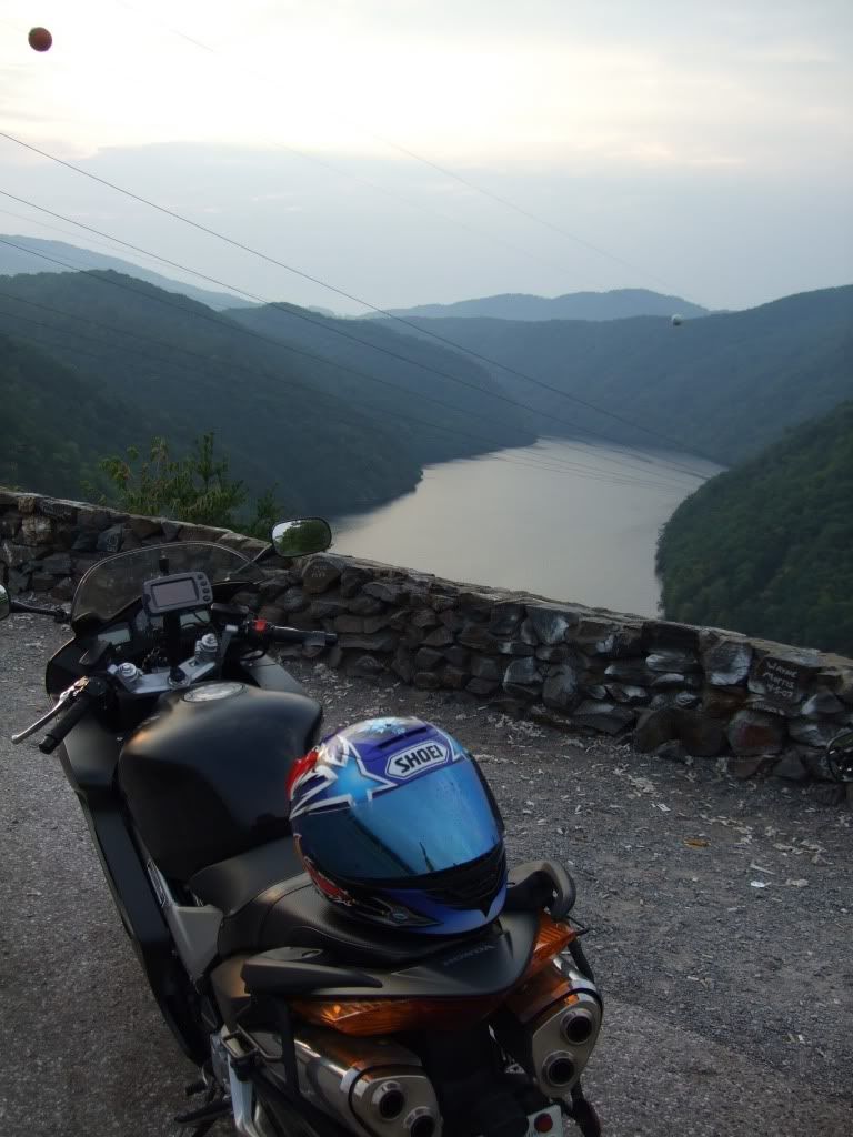 It was indeed a very nice piece of road, but sadly spoiled by all the traffic and cops. We decided that the only way to really enjoy it was to do it Monday morning at 7:00 in the morning.
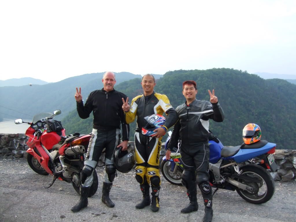
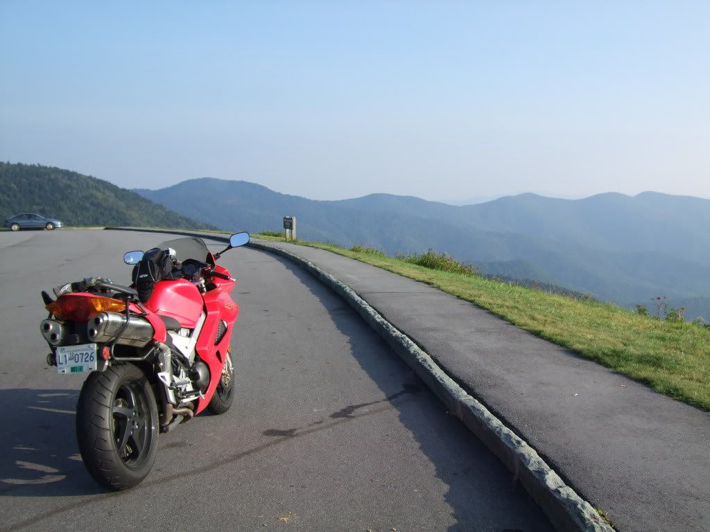
 Once we unloaded our bags and grabbed some quick lunch, we decided ride the Blue Ridge Parkway, one of the many recommended roads in the are. It was mostly 45 miles sweepers with a few 20 mile hairpins. It had clean pavement and little traffic. The road is very scenic and basically takes you through multiple mountain ranges. The road actually goes on for 596 miles long so needless to say, we were not going to complete it. We were also too pre-occupied with taking photos to get anywhere fast. The mountain backdrop from up top is simply amazing! It has layers beyond layers of mountain in multiple shades of grey. I guess this is why they call it the Smoky Mountains. It was definitely different from the Rockies vista that we have back home. With all the picture taking, we had run out of time. We decided to turn back after the summit and headed back to Deals Gap to see if the State Troopers were still around. We only rode to the Deal's Gap resort before we headed back because it got dark pretty fast.
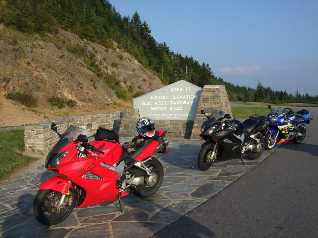
 Day 10 - Robinsville, NC to Bowling Green, KY
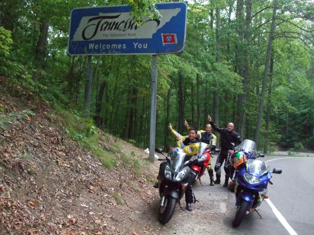
 We got up early and headed out at dusk like a bunch of eager boy scouts on the first day of camp. The morning run to Deals Gap definitely paid off. There was no traffic and thank-god no cops! We had an awesome run with speeds to our hearts content. This road (less the traffic) is really what it's cracked up to be. It's non-stop twisties, tightly wound together to give you a ride you would not soon forget!
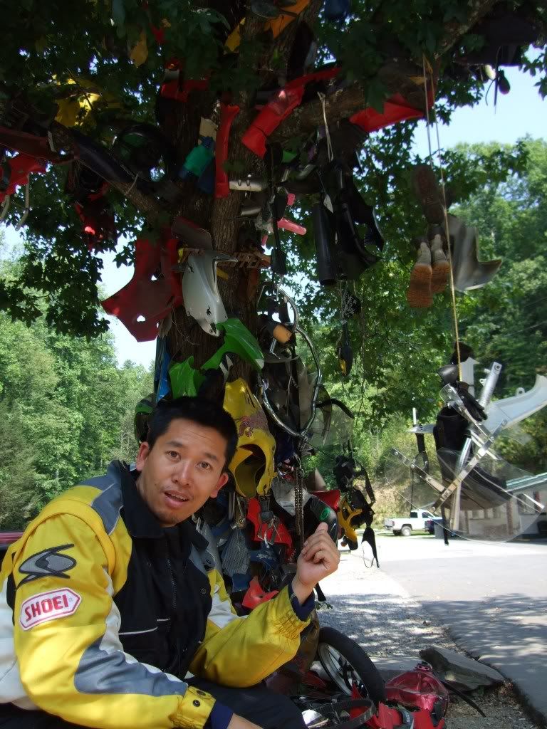
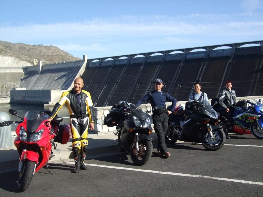
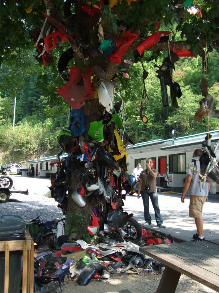 After getting a few rounds of adrenaline fixes, we dropped by the Deals Gap Resort store and chatted up with the locals. Surprisingly I did not see a fraction of the harleys we saw yesterday. All the bikes we saw this morning were sportbikes and they were really enjoying themselves. These must be the locals as they know when is a good time to ride this road.
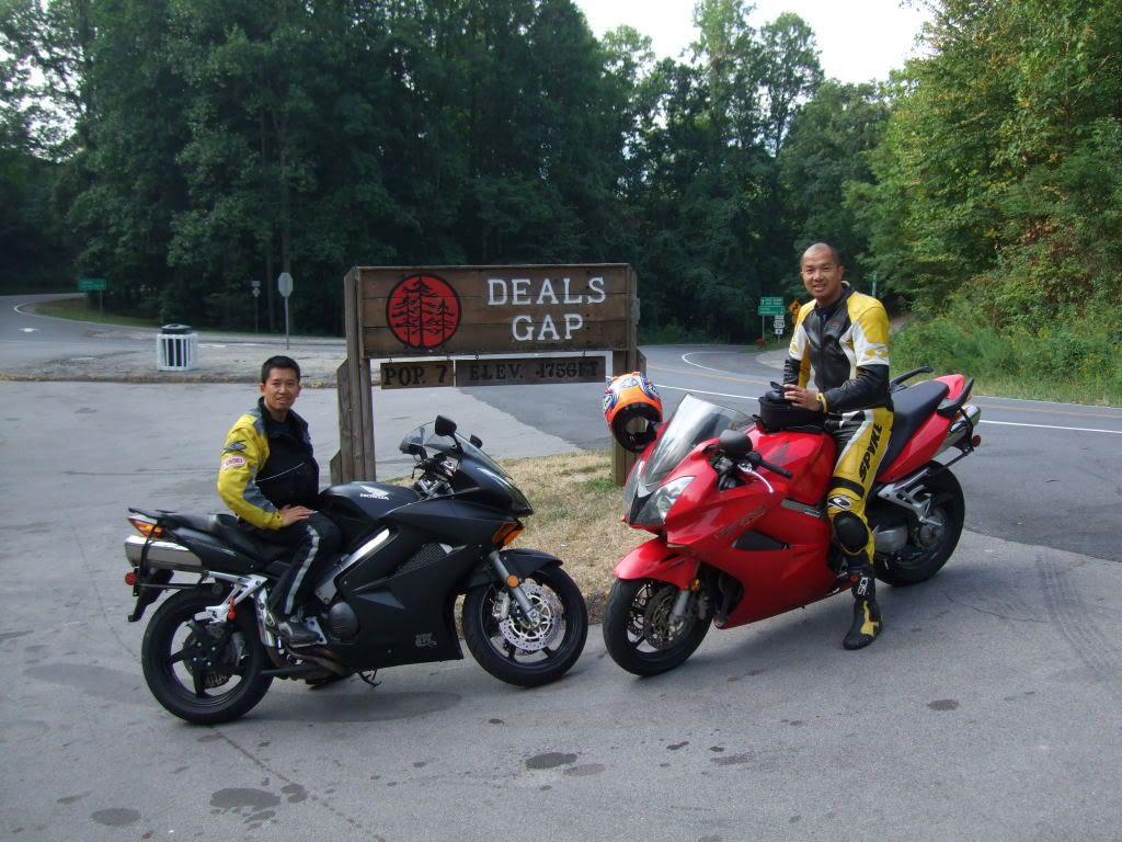
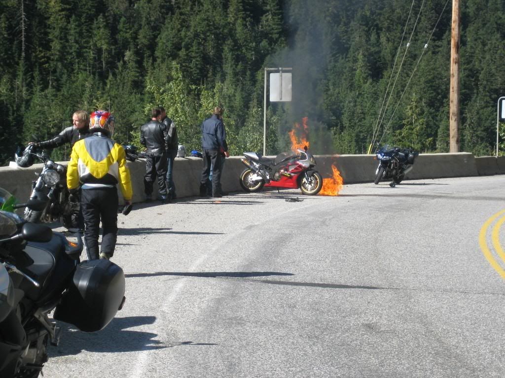
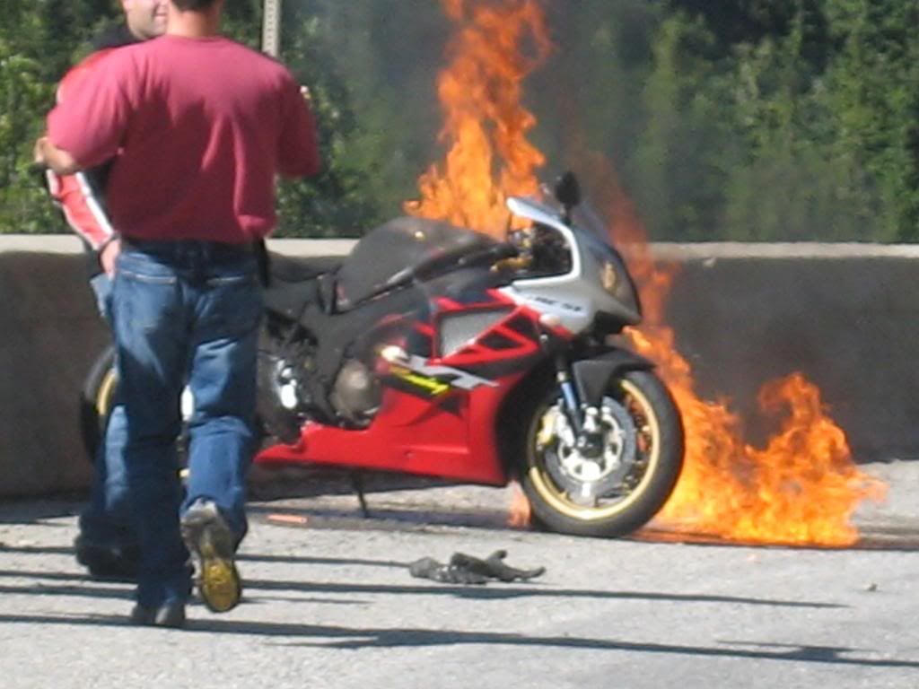
 After doing the mandatory souvenirs thing, we left the store and decided to ride the other "must-do" road around here (Cherohala Skyway) on the way out. Just before getting onto the skyway, our good luck turned for the worst. Stan, who just happily "conquered the Dragon" wiped out going wide after seeing some gravel. Fortunately, it was at low speed and his bike was still ridable. Besides losing one of his hardbags and some scuffs on the right fairing, the bike held up well.
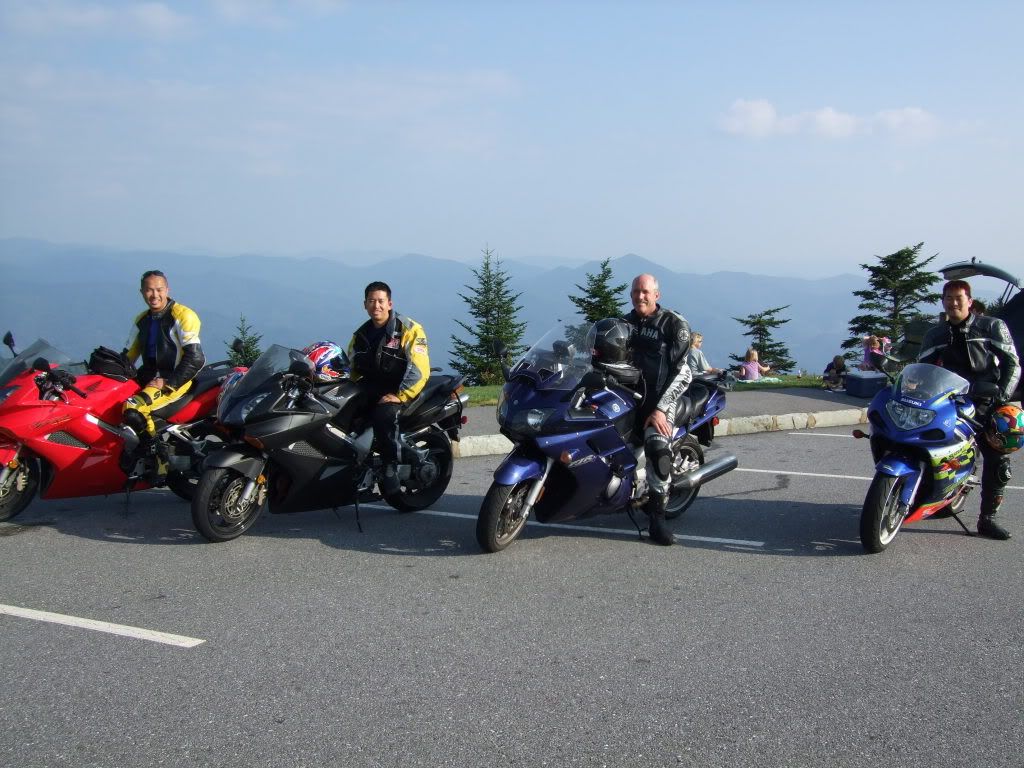 We continued onto Cherohala but did not enjoy it as much as we could have. This road is similar to Blue Ridge where it goes up and down along the mountain tops. It's also very scenic and the roads are a little tighter than Blue Ridge but not as much as Deals Gap. If you are looking for something scenic with some fun twisties, this would be it.
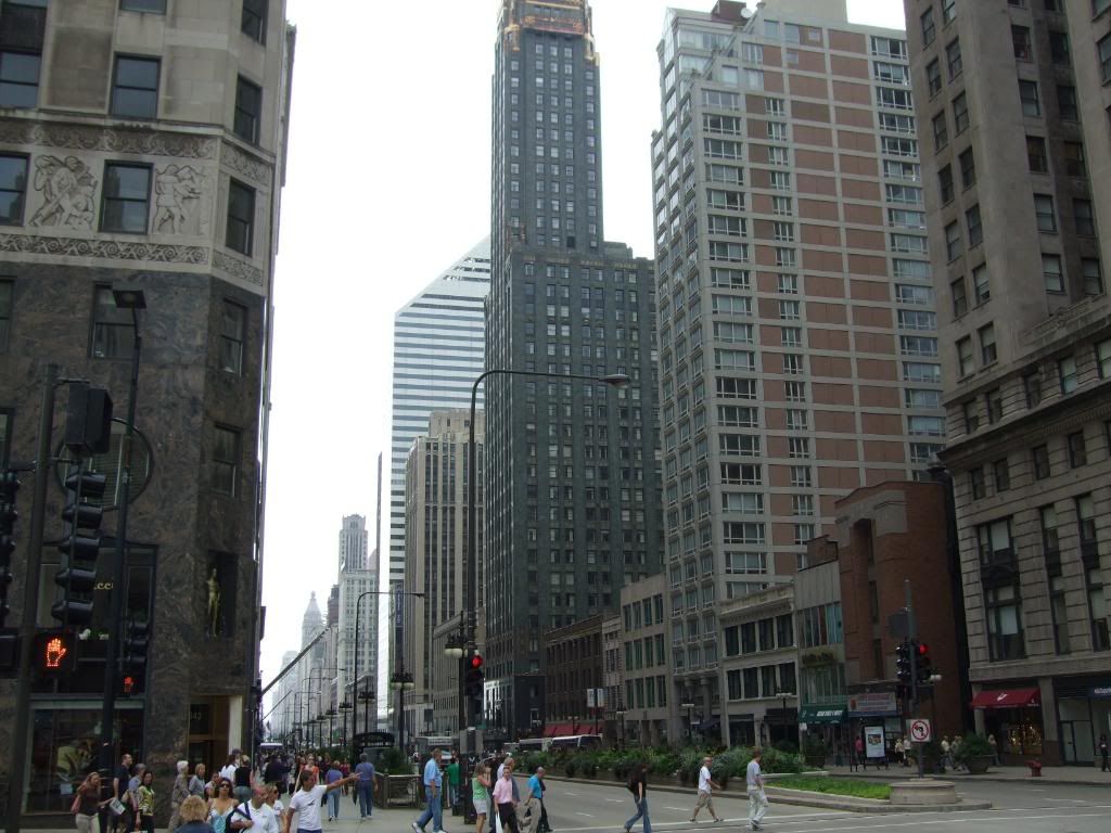 Chicago was one of the two planned rest cities. The idea was to stay here more than a night to get some R & R. We checked into the Travel Lodge right by the Loop (downtown of Chicago loving called such because of the loop that the overhead commuter trains make around this busy area). We found the people to be very friendly. The city is beautiful with lots of architecture to see, so that was a treat for me.
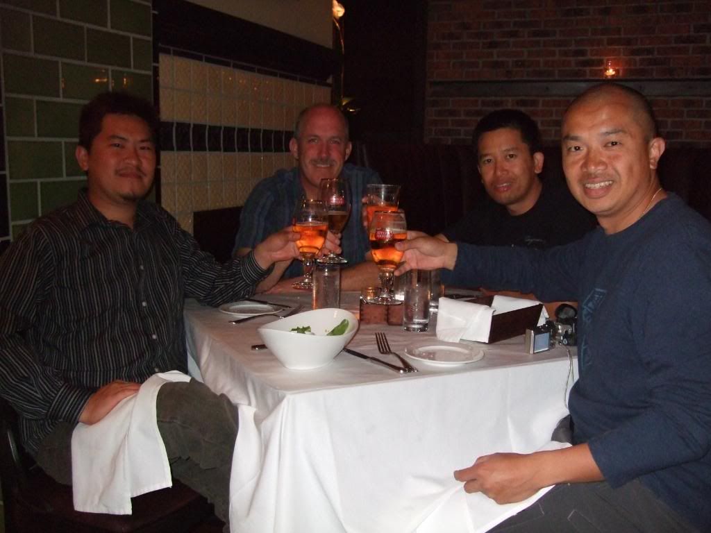 After checking in, we decided check out the restaurant scene and went for a nice dinner at a new highly recommended restaurant called Gage. The interiors were beautiful, reminescent of an old train station. The decor pieces were very fitting and reminded me of the early 1900's. The food was excellent and an inviting change from all the fast food we've been having on the road. The server was really friendly and openly suggested some great night spots in town. It was very tempting, but having a long day of lost and found, we decided to just walk across the strret to Millenium Park instead.
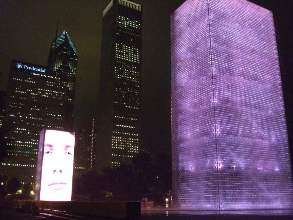
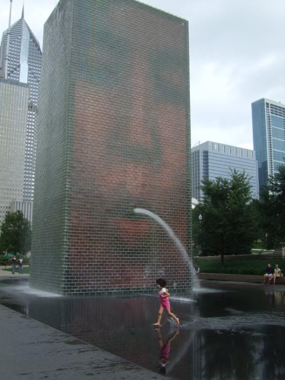 Millenium Park is a 24 acre public park and cultural centre built over old railroads just in time for the new millenium. It consists of many public areas, one of which is a Frank Gehry designed outdoor music pavillion. Another cool area is the Crown Fountain designed by artist Jaume Plensa. It consists of two 50 foot tall glass block towers with an oversize video image of a person's face projected onto the side of the tower. There are a few different faces that were taken from a cross-section of 1000 Chicago residents. The cool thing is that these faces don't appear to do much, but if you wait long enough, their mouth starts to pucker up and water spouts out from it. Children really enjoy this fountain and it's especially funny seeing some of the unknowing children be by startled by this sudden burst of water over where they are standing. The inspiration was apparently the Gargoyles traditionally found at the top of buildings, but here they used residents instead.
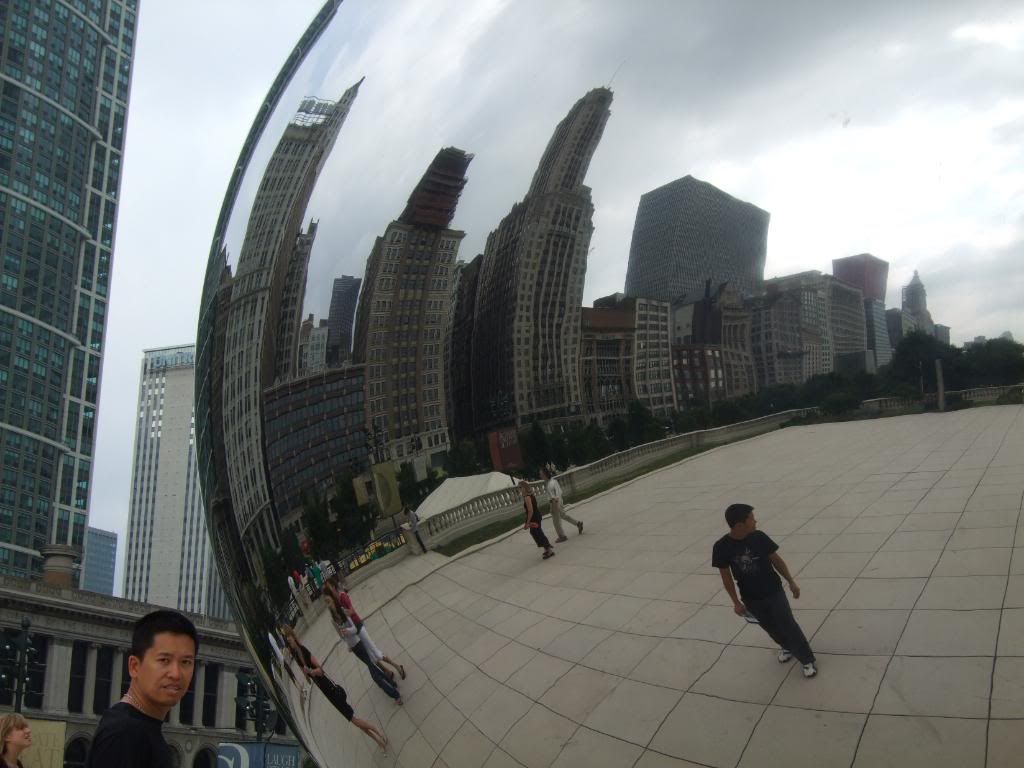
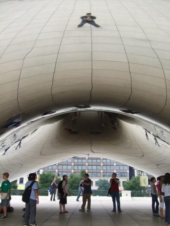
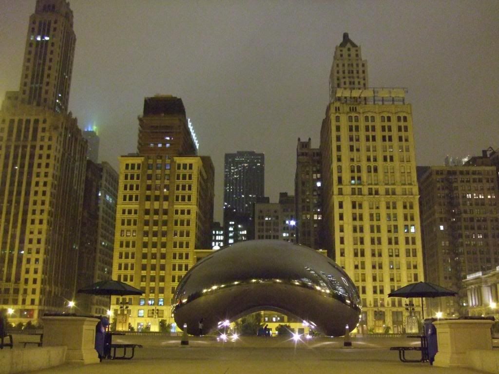 Another very cool attraction in this park is Cloud Gate or loving called "The Bean" by the locals. It's a mirror polished stainless steel elliptical sculpture that's visibly seamless. Designed by Anish Kapoor, this sculpture is like a giant kidney bean which reflects and distorts the cityscape in weird and wonderous ways. It is so captivating, you can spend hours just looking at reflections from different angles. I was like a little kid in a fun house of mirros. Pictures can not do it justice. In fact, we liked it so much we went back again in the day time the next day. I would recommend anyone to make a trip to Chicago, even if it was just to see this.
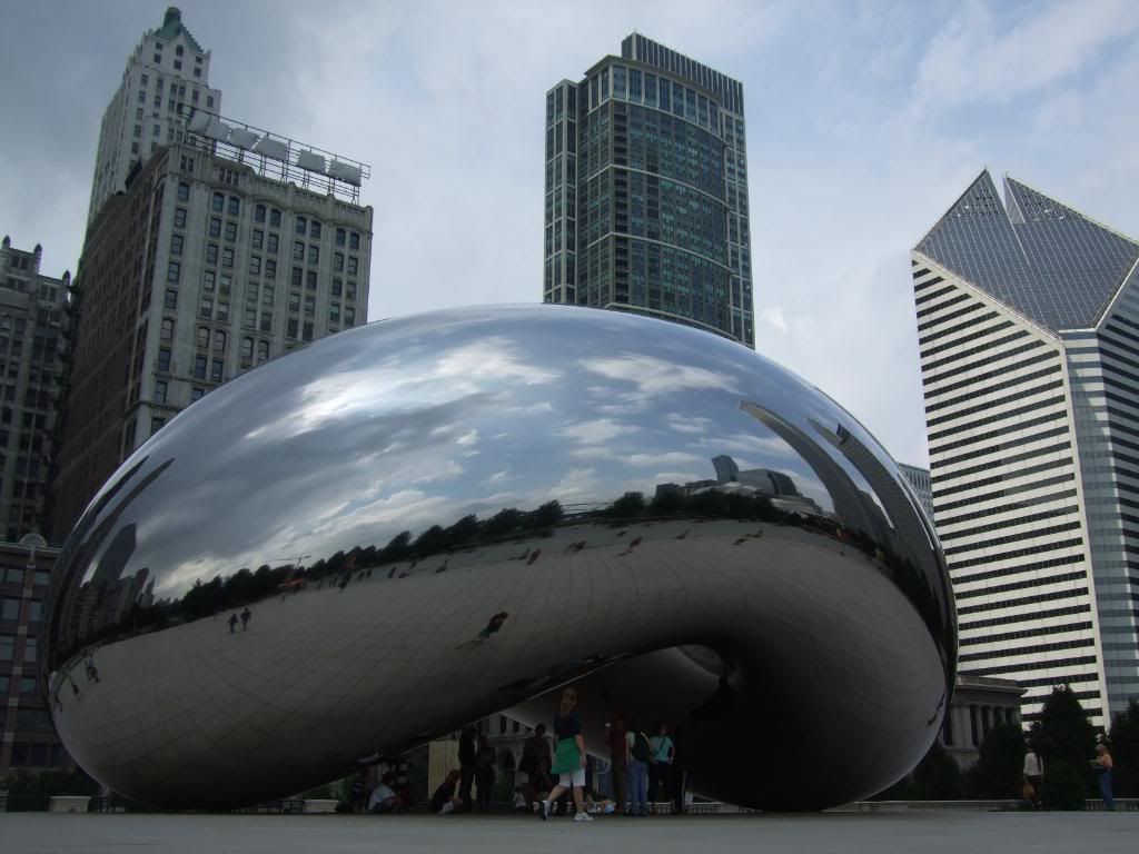
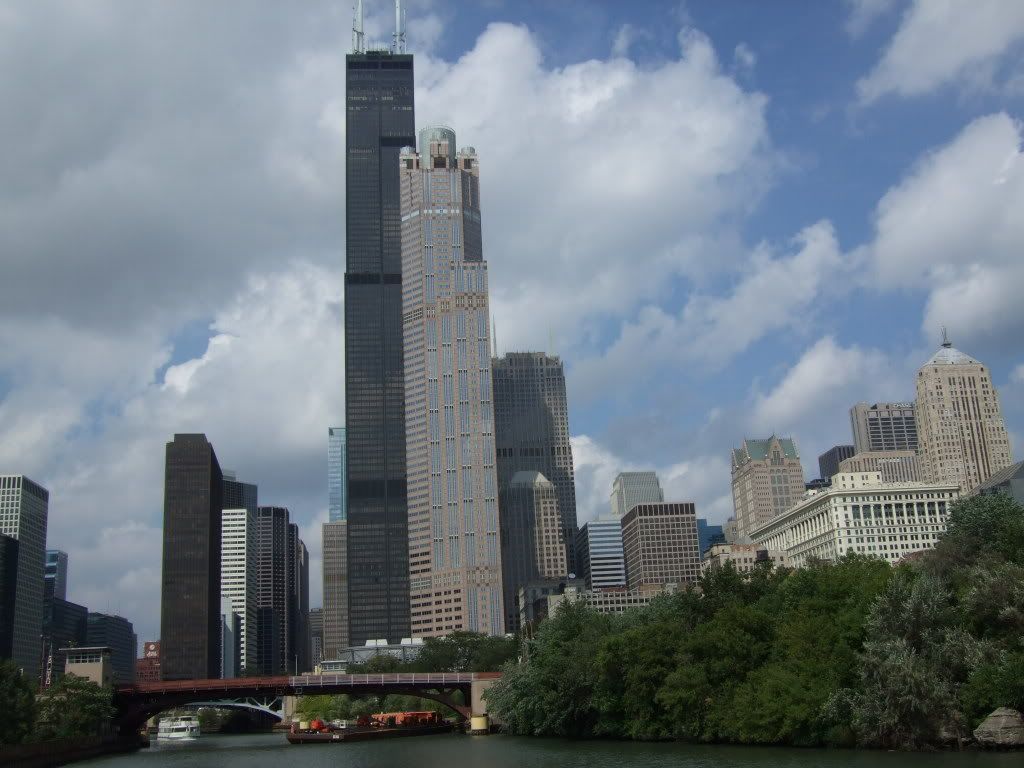
 Our 2nd day in Chicago was spent mostly sight seeing. We joined an architectural boat cruise tour which pointed out significant buildings and history along the Chicago river. After the tour, I commuted out to pick up my bike and the rest of the gang continued to play tourists.
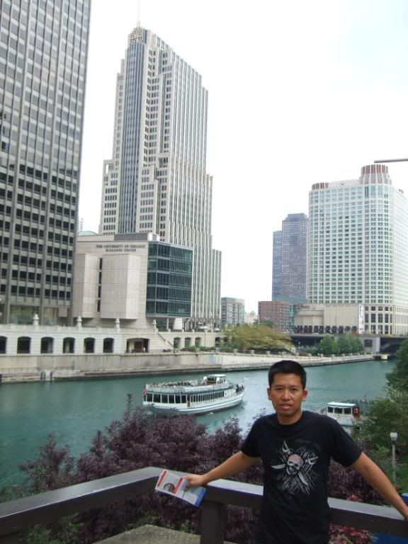
 I under-estimated the commute out to the sub-burb town where the bike dealer was and missed them by 15 mins. I had no choice but to commute back into downtown and hence wasted a total of 6 hours! It was a good thing I'm on vacation because I would be really pissed if it happened at home where my time is always prescious. I had no choice but to make the best of it. I guess this is when the PDA games come in handy.
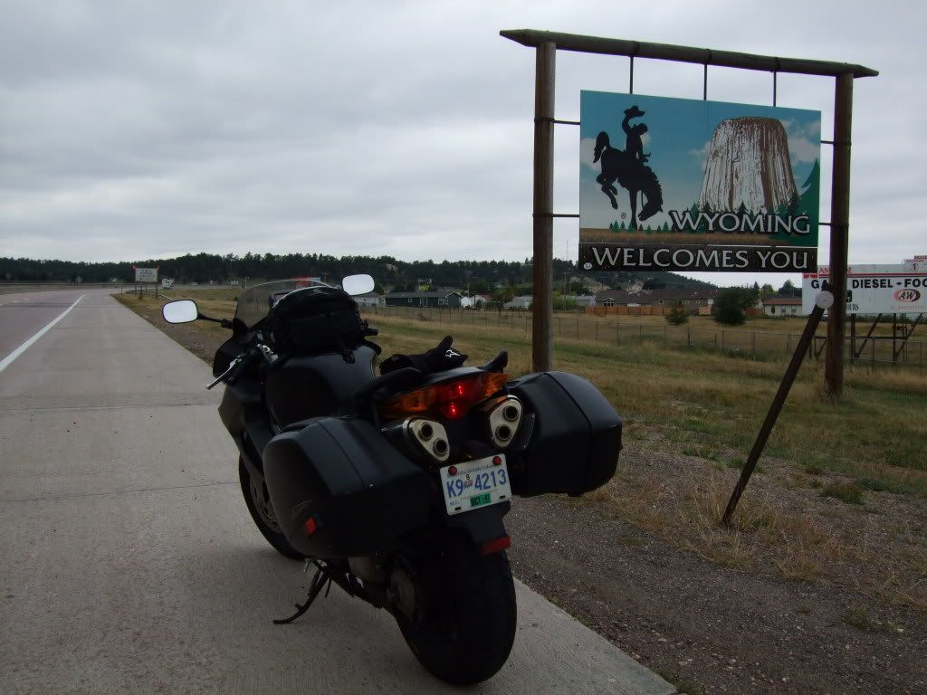
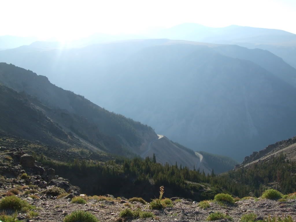
 Highway 12 (a.k.a. Lewis & Clark Trail) out of Lewiston follows the Clearwater river through a few National Parks and leads us to the day's anticipated ride, Lolo Pass. Highway 12 starts off meandering along with the river making for a very scenic, calming ride.
 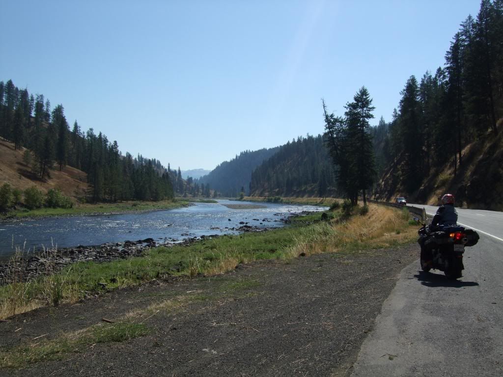 As we near Lolo National Forest and saw a sign that said "Winding road next 77 miles", we knew the real fun was just getting started.
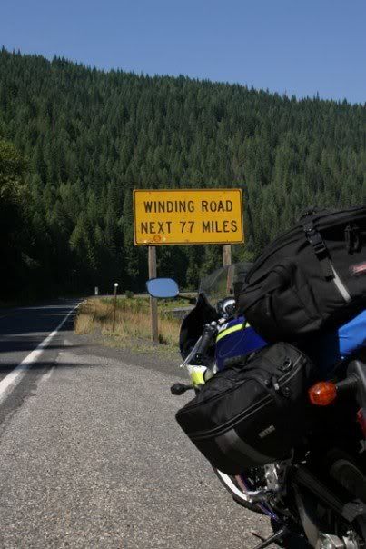
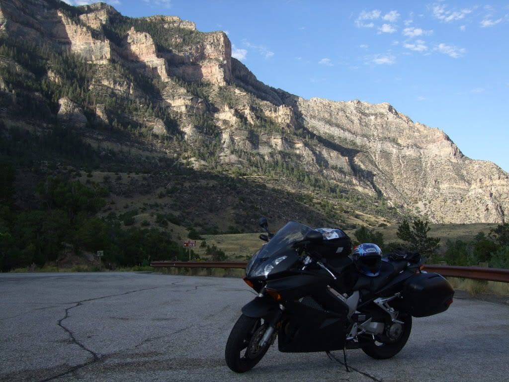
 Yellowstone National Park was on our list of sights to see. We decided to enter from the west gate and do a half loop through Old Faithful. The traffic was expectedly slow and filled with tourists. Once we adopted the pace, we were able to appreciate the majestic scenery. It's amazing how wild this park is. There were heards of buffallos grazing in hectares of untamed fields everywhere. We stopped by the small Geysers and mud pots, but missed seeing Old Faithful go off by just a few minutes. The park is huge (10,000 sq. miles in fact), it just seems to go on forever. More than half of our day was spent at the park, yet we only did half of the small loop and there was no sign of Yogi Bear anywhere.
 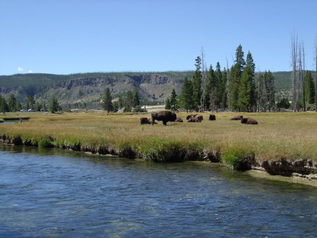 We exited Yellowstone from the northeast gate to hook up to Highway 212 with Beartooth Pass as destination. The slow traffic and repetitive clutching & braking through the park really tired Chuck and Michael out. They decided it was best to stay behind and recuperate as the rest of us challenged Bear Tooth Pass.